Tides for Divers, Swimmers and Beachgoers: Springs, Neaps, Slack Water and Why the Sea Moves When It Does
Tides follow the moon, not the season. Spring tides are the big ones, slack water is not always at high or low tide, and the hour that matters for a dive or a swim is the one the tables show for your own coast.
Wednesday, September 23, 2026/4 min read
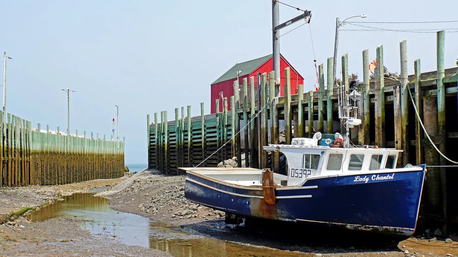
Anyone who dives, swims or walks on a coast with a real tide learns the same lesson at some point: the sea does not wait. A beach that was wide at noon is gone at four, a calm channel becomes a river at mid-tide, and a dive planned for the wrong hour is a different dive. The tide is among the most predictable things in nature and among the least understood by visitors. A little of the mechanism makes the tables much easier to use.
What causes it
Tides are produced mainly by the gravitational pull of the moon, with a smaller contribution from the sun. NOAA's National Ocean Service explains the process in its tides primer: the moon's pull draws a bulge of water toward it, and a second bulge forms on the opposite side of the Earth, so that most coasts have two high tides and two low tides in a lunar day of about 24 hours and 50 minutes. That is why the times of high water move later by roughly 50 minutes each day. Some coasts have only one high and one low a day, and many have a mixture, so the pattern for your coast is the one to check.
Springs and neaps
When the sun, moon and Earth are lined up, at new and full moon, their pulls add together and produce spring tides, with the highest highs and lowest lows. At the quarter moons, when the pulls are at right angles, you get neap tides, with a smaller range. NOAA's explainer on spring tides is clear on a point that the name confuses: springs have nothing to do with the season of spring. They come roughly every two weeks, so a coast has a pattern of bigger and smaller tides that cycle through each fortnight. The range itself varies enormously with geography, from under a metre on some sheltered coasts to more than ten metres in places such as the Bay of Fundy.
The flow of water
The rise and fall of the tide is the visible part, and the flow that results is the part that matters to divers. As the water rises and falls, it moves horizontally as tidal streams, which are strongest roughly midway between high and low water and weakest around the turn. A common planning aid is the rule of twelfths, which approximates how the water level changes through a six-hour half cycle: one twelfth of the range in the first hour, two in the second, three in each of the third and fourth, two in the fifth, and one in the last. It is a guide, not a promise, but it shows why the middle two hours are the ones that move the most water and fastest.
Slack water is not where you think
Slack water is the period when the stream stops before reversing, and it is the window many dives in tidal channels are planned for. It does not necessarily coincide with high or low water. In channels, straits and estuaries the stream can keep running for an hour or more after the water level at the coast has turned, so the tide tables for height are not enough. Use tidal stream atlases or local current predictions, and ask the local operator, who will know the quirks. For what to do when the current picks up underwater, see our guide to drift diving and currents.
The tables, and what the weather does to them
Predictions are only predictions. The national hydrographic offices publish them, in the UK through the UK Hydrographic Office's EasyTide service, and in the US through NOAA's Tides and Currents pages. They are calculated from astronomy and local measurement, and they do not include the weather. A strong onshore wind and low pressure can raise the sea above the prediction, and an offshore wind and high pressure can lower it. Low pressure alone lifts the sea by roughly a centimetre for every hectopascal below normal.
Using it
- Check the tide times and the height for your own site and day, not a nearby harbour that is a different place.
- For shore entry, think about the exit: a beach that is easy at high water can be a field of slippery rock at low.
- Do not cross a causeway or sandbank without checking the return time and allow a margin.
- Plan tidal channel dives around slack water, and carry a surface marker.
- Wind against tide stands up steep waves in narrow channels even on a calm day.
The sea gives plenty of notice if you ask it in the right way, and the right way is a printed table, a few minutes of arithmetic and a local who knows the water.
Published in The Outspoken Digest
Editorial desk
Outspoken Digest Diving DeskCovers freediving, recreational and technical diving, dive medicine and the incidents the sport learns from.
Newsletter
The Digest, in your inbox
One edition, sent when it is ready. No noise, and your address is never passed on.
Read Next
More Diving →
Breathless and Coughing Pink Froth After a Dive: Immersion Pulmonary Edema Explained
Oct 17, 2026/3 min read
Your Gas Consumption Is Not One Number: Why Depth, Cold and Nerves Change It
Oct 16, 2026/3 min read
SS United States Reef Sinking Targeted for November: What Divers Should Know
Oct 16, 2026/2 min read
Divers Excavating Off Kekova Find a Wreck Believed to Be the World's Oldest, Turkey Says
Oct 15, 2026/2 min read