Drones Are Becoming Everyday Infrastructure for Land Stewardship
Texas land-management work shows how drones and spatial data are shifting from spectacular aerial tools to routine systems for monitoring soil, water and vegetation.
Outspoken Digest Technology Desk
Friday, July 24, 2026/2 min read
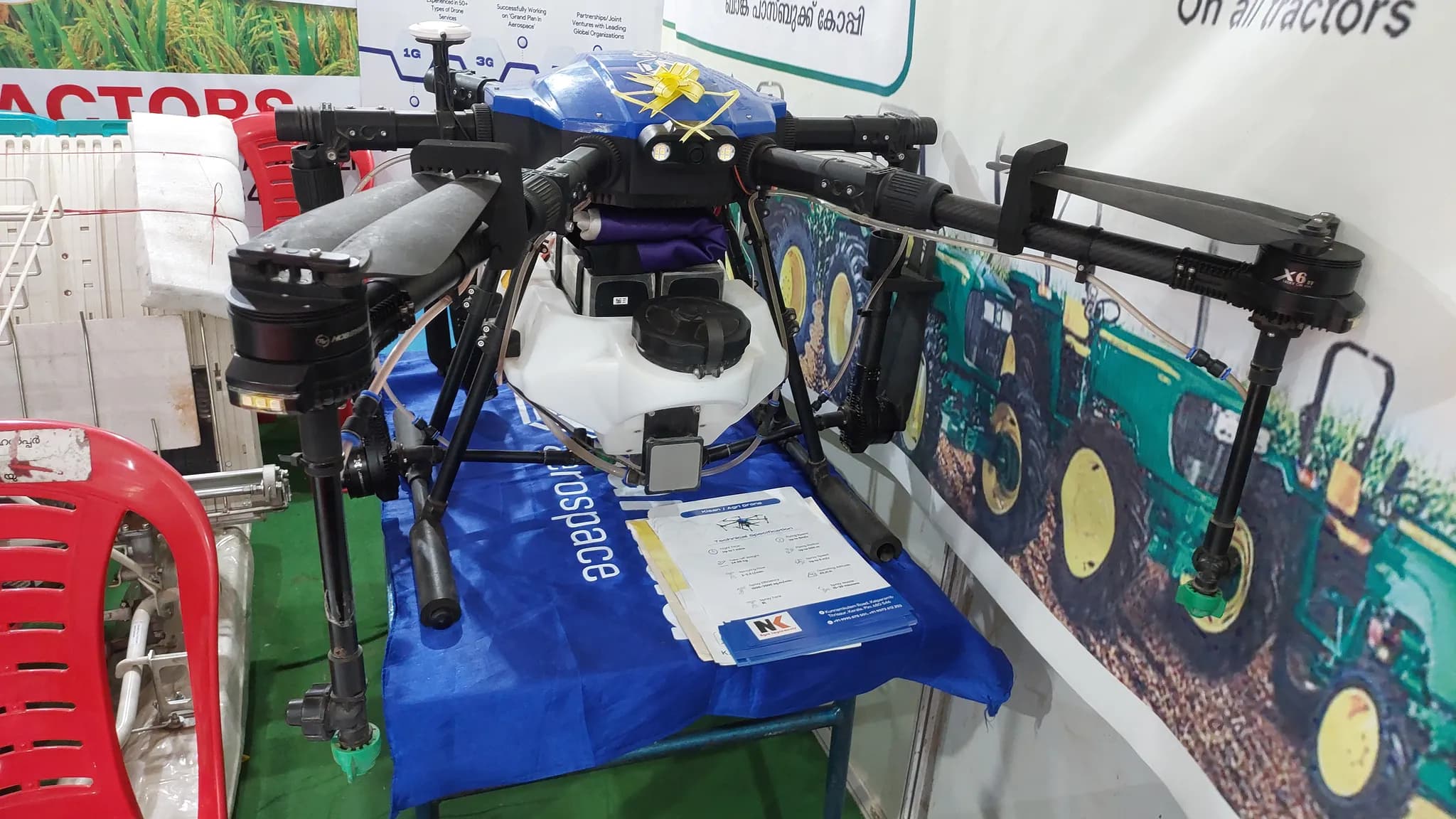
Drones are settling into a less cinematic and more valuable role: repeated observation. Land managers can use the same flight path to monitor vegetation, erosion, water and grazing patterns, producing a record that is more consistent than occasional ground inspection alone.
This article was prepared for the July 24 edition using current reporting and official background material. Texas A&M land stewardship research provides the immediate frame, while FAA guidance for drone operators supplies the institutional context needed to interpret it.
What changed
Recent Texas work highlights the combination of aerial imagery and spatial analysis. The aircraft is only one part of the system. Value comes from calibrated sensors, repeatable collection, accurate mapping and people who can translate an image into a land-management decision.
The distinction between an announcement and a durable change matters. Headlines describe the new development; evidence over the next several weeks will show how widely it is used, how institutions respond and which early assumptions survive contact with operations.
Why the story matters now
Satellites cover large areas, while ground surveys provide detail. Drones sit between them, offering high-resolution observations on demand. That makes them useful after storms, during drought and when managers need to identify a change before committing labor or equipment.
USDA precision agriculture resources offers an additional reference point. Read together, the sources show why this story is not isolated: it connects policy, infrastructure, public confidence and the incentives of organizations expected to act.
What readers and organizations should do
Adoption requires more than buying hardware. Operators need aviation compliance, landowner permission, data-storage rules and a plan for analysis. Poorly designed flights can collect huge volumes of imagery without answering a practical question. The best projects begin with the decision that the data must support.
- Check the date and scope of official notices before acting.
- Separate verified operational facts from forecasts and promotional claims.
- Keep a practical alternative when transport, health, finance or technology decisions are time-sensitive.
- Revisit the situation as new evidence becomes available.
What to watch next
Expect more automated comparison between flights, including models that flag unusual change. The critical safeguards will be transparency, privacy and human review. A colored map can guide inspection, but it should not become an unquestioned substitute for local knowledge.
The useful response is neither complacency nor alarm. It is to identify what has genuinely changed, who bears the risk and which indicators can confirm whether the first-day narrative was accurate. That is the standard Outspoken Digest will use as the story develops.
Published in The Outspoken Digest
Editorial desk
Outspoken Digest Technology DeskSoftware, hardware, artificial intelligence and what they change for everyone else.
Newsletter
The Digest, in your inbox
One edition, sent when it is ready. No noise, and your address is never passed on.
Read Next
More Technology →
Anthropic Researchers Warn Small AI Models Could Soon Copy Themselves Onto Smart TVs and Other Home Devices
Oct 13, 2026/3 min read
Microsoft Unveils Maia 300 With 288GB of HBM4 and a 96-Chip Rack, Claiming Up to Seven Times Maia 200 Throughput
Oct 13, 2026/2 min read

Nvidia Opens Its Vera Rubin Rack Designs to the Open Compute Project and Pushes Racks Up to 250 Kilowatts
Oct 13, 2026/2 min read

Bronze Ring Engraved With the Lighthouse of Alexandria Found in the Sunken Royal Palace on Antirhodos
Oct 13, 2026/2 min read