Colombia's Deadliest Earthquake in a Decade: What Happened on 10 August
A magnitude 7.4 struck western Colombia at 7.34am local time, 110 km beneath Choco. It was felt in 32 departmental capitals, brought down a cathedral tower in Manizales, and the toll is still moving.
Wednesday, August 12, 2026/3 min read
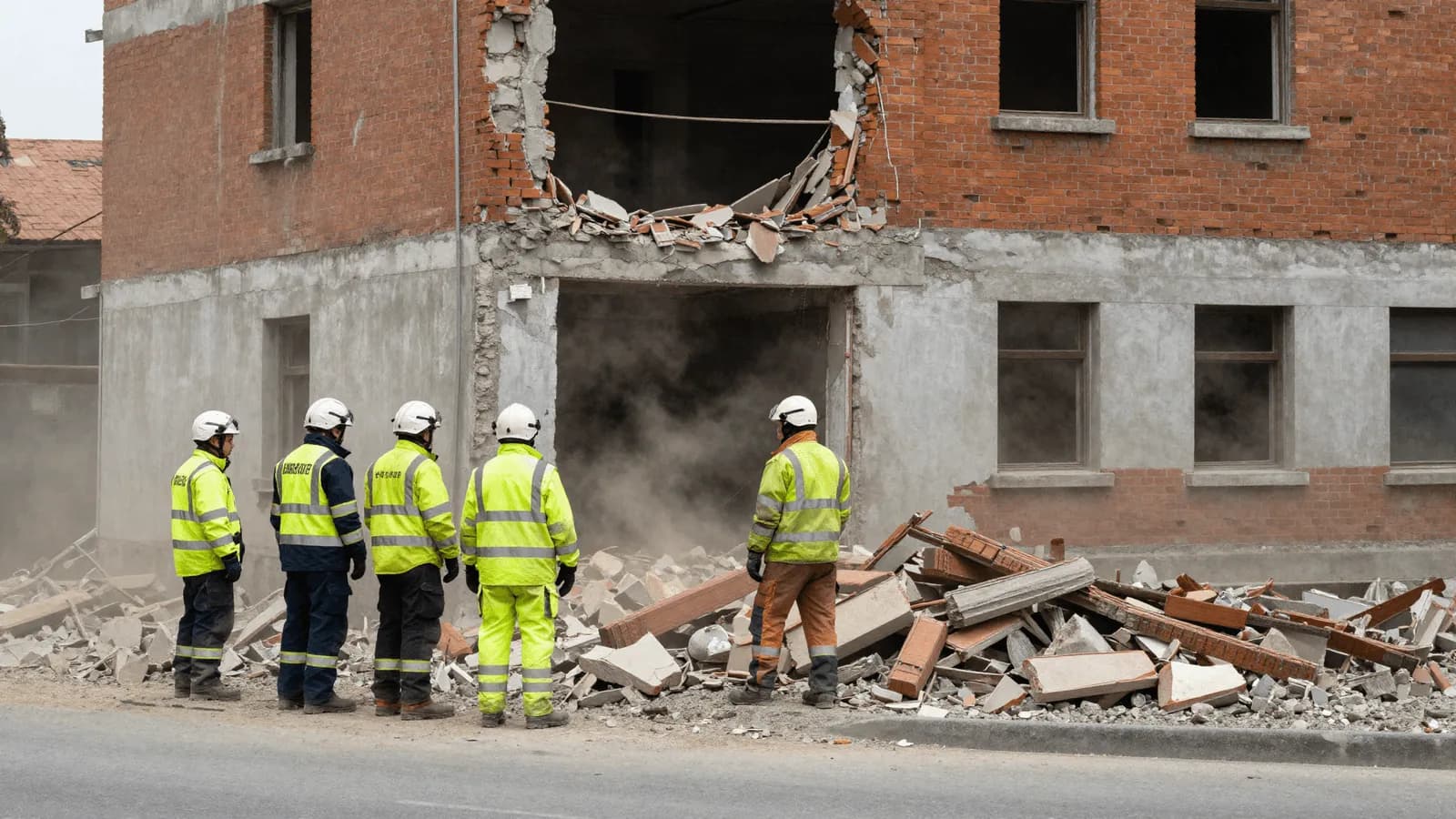
At 7.34am local time on Monday 10 August 2026, a magnitude 7.4 earthquake struck western Colombia. The epicentre was about 20 km from San Jose del Palmar, a town of roughly 5,000 people in Choco department, and the shaking lasted close to two minutes.
It was the largest earthquake to hit the country in a decade, and it was felt in 32 departmental capitals, which is to say almost everywhere.
The technical picture
- Magnitude: 7.4
- Depth: around 110 km according to the USGS, around 96 km according to the Colombian Geological Survey
- Mechanism: strike-slip faulting inside the subducting Nazca plate, not on the plate boundary itself
- Maximum intensity: Modified Mercalli VIII, severe, near the epicentre
- Peak ground acceleration: 0.427 g recorded at Jamundi
- Aftershocks: more than 100, the largest a magnitude 5.0 at 8.18am
The depth is the most important number and the least intuitive, which we explain separately in why a deep earthquake can still flatten buildings. In brief: depth spreads the energy over a much wider area rather than concentrating it, which is why a rural epicentre produced damage in cities more than a hundred kilometres away.
The human toll
The figures moved substantially through the week, as they always do. Early reporting on Monday evening put the dead at around 132. By Tuesday the count was above 200. Compiled tallies now put deaths above 265, injuries above 3,700, and the number of people recorded as missing in the thousands.
Numbers this unstable deserve a caution rather than a headline. Missing figures early in a disaster include people who are simply unaccounted for because communications are down, and they typically fall sharply. Death tolls usually rise. Neither should be read as final.
Recorded damage includes over 8,300 homes damaged and more than 1,100 destroyed, 48 buildings collapsed, and around 796 educational institutions affected.
Where the damage concentrated
Not at the epicentre, which is thinly populated, but in the cities.
In Cali, the mayor reported 32 collapsed buildings, including a significant part of a hospital. A hospital failing during an earthquake is the worst possible compounding failure, because it removes capacity exactly when demand spikes.
In Manizales, in the mountainous coffee region, one of the towers of the neo-Gothic cathedral collapsed into the nave, and the city's cable car system was suspended after structural damage. Manizales sits on steep terrain, which introduces landslide risk on top of shaking.
The response, and one notable decision
Colombia declared a national disaster. Rescue operations were activated, and economic emergency measures announced.
International offers of help came from Ecuador, Venezuela, the United States, which pledged 15.5 million dollars, Israel and others. Colombia reportedly declined foreign search and rescue teams while accepting financial support.
That decision will be debated, and it is less unusual than it sounds. Foreign urban search and rescue teams take 24 to 72 hours to arrive and require substantial local coordination, by which point the survival window in collapsed structures has largely closed. Countries with capable domestic capacity often conclude that money and materials help more than more people on the ground. Whether that judgement was right here will depend on what the recovery in Choco looked like, and reporting from the epicentral area was slow because the roads were cut.
Why western Colombia
Colombia sits at one of the more complicated tectonic junctions on earth, where the Nazca, Caribbean and South American plates interact. The Nazca plate subducts beneath the continent, and most large Colombian earthquakes originate in that process.
This one was unusual in occurring inside the descending slab at intermediate depth, in a zone where the rock is cooler than surrounding mantle and can still fracture rather than deform. Colombia has had events like it before, including the intermediate-depth earthquakes felt strongly in Bogota in 2023.
What this tells the rest of the world
Three things, and none of them are about Colombia specifically.
First, building performance decides the toll. A magnitude 7.4 at 110 km depth is survivable almost everywhere with modern construction and lethal wherever construction is old, unreinforced or informal. The earthquake did not choose the 48 buildings that collapsed. Their construction did.
Second, critical facilities need to be built to a higher standard than housing. A hospital that fails in an earthquake fails twice.
Third, this happened without warning of any kind, because that is the only way earthquakes happen. Claims circulating afterwards that someone predicted it deserve the scrutiny we give them in why earthquakes cannot be predicted.
What can be done is preparation, and the practical version of that, drawing on guidance from the Gulf, the United States and Europe, is in our safety guide.
Published in The Outspoken Digest
Editorial desk
Outspoken Digest NewsroomReports for The Outspoken Digest across Latest Trends, Lifestyle.
Newsletter
The Digest, in your inbox
One edition, sent when it is ready. No noise, and your address is never passed on.
Read Next
More Latest Trends →
Federal Agents Search Rep. Ilhan Omar's Washington Home Three Weeks Before the Midterms, and She Calls It Intimidation
Oct 13, 2026/2 min read
Iran Calls the US Reply on Hormuz 'Inadequate' as Two Indian Seafarers Go Missing After a Tanker Is Hit Off Oman
Oct 13, 2026/2 min read
Trump Declares a Russia-Ukraine 'Energy Ceasefire' and Moscow Keeps Hitting Ukraine's Power Plants, Zelenskyy Says
Oct 13, 2026/2 min read
Saudi Arabia Vows a Serious Response After a Houthi Missile Killed 13 at Riyadh Airport as Trump Weighs Joining
Oct 13, 2026/2 min read